
February 24, (THEWILL) – Report of preliminary investigation on the fatal air crash that killed Herbert Wigwe, the Group Chief Executive Officer (GCEO) of Access Holdings Plc, revealed that law enforcement and witnesses in vehicles saw the helicopter as a “fireball” before it crashed.
THEWILL reports that Wigwe died in a helicopter crash alongside his wife, son, and a former chairman of the Nigeria Exchange Group, Abimboloa Ogunbanjo. The chopper with registration N130CZ crashed on February 9, 2024, in California, United States.
According to the US National Transportation Safety Board (NTSB), the witnesses reported that the weather on the fateful day of the helicopter crash was a mix of rain and snow.

In a preliminary investigation, NTSB said the automatic dependent surveillance-broadcast (ADS-B) technology built in the helicopter that provides the position of an aircraft, recorded an increase in ground speed before the crash.
According to the report, “The accident flight departed Palm Springs International Airport (PSP) at 2045 under visual flight rules and flew a northwesterly heading for about 2 miles before following US Highway 111 to Interstate (I) 10 at altitudes varying between 2,500 – 3,000 ft mean sea level (msl).”
“The helicopter continued along I-10, crossed over San Bernadino International Airport, San Bernadino, California, and then followed I-215 to I-15.
“The helicopter followed I-15 toward the planned destination of Boulder City Municipal Airport (BVU), Boulder City, Nevada, climbed between 4,000 – 5,500 ft msl, then descended to about 3,500 ft msl near Barstow, California, where the ADS-B track data was lost about 2146, likely due to terrain interference.
“ADS-B data resumed at 2207 near the Halloran Springs/I-15 exit west of the accident location. The last ADS-B data points for the flight tracked east-southeast, gradually descended in altitude, and increased in ground speed (see Figures 1 and 2).
“The accident site was located 0.31 miles east-southeast of the last data point at an elevation of about 3,360 ft msl.
“According to law enforcement, several witnesses, who were travelling in vehicles on I-15, called 911 to report observing a ‘fireball’ to the south.
“The witnesses reported the weather conditions in the area were “not good” and raining with a snow mix. The accident site was located by law enforcement at 2346.
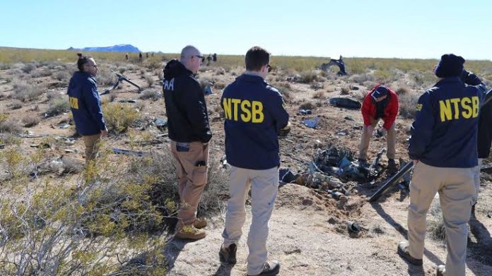
“The wreckage was located in high mountainous desert and scrub brush-covered terrain, and debris was scattered about 300 ft along a 120° magnetic heading from the initial impact point. All major helicopter components were identified at the accident site,” the report read in part.

Felix Ifijeh is a journalist with years of professional reporting experience. Known for his keen news sense, compelling storytelling and commitment to accurate, impactful reporting, he has built a reputation for turning leads into clear, engaging, and well-structured reports that resonate with readers. His work reflects deep newsroom experience and a commitment to accurate, impactful journalism.